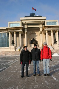
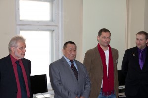
 In this capacity a team from terrestris travelled to Mongolia where it is conducting a geodata management workshop at the Technical University in Darkhan (MUST). On the occasion of the opening of the workshop by the scientific coordinator of the MoMo project, Dr. Daniel Karthe, the German Ambassador to Mongolia, Dr. h.c. Peter Schaller greeted the participants. In his address he emphasized amongst other aspects the importance of knowledge and skills for a national economy and was pleased about the german-mongolian cooperation. The director of the Technical University, Prof. Dr. Dorligsuren Lkhanag, also addressed the participants and mentioned that such a geodata management workshop was a first at MUST.
In the allotted 5 days fundamental concepts of geographical data handling and manipulation will be dealt with on a theoretical basis. There is also the chance to put this newly gained knowledge into practice by working with the free and open source desktop GIS Quantum GIS. The practical side of the workshop is being augmented by mapping excersises with GPS devices on 2 of the 5 days.
The results will be published on the OpenStreetMap platform and will thus be available to the public. Approximately 80% of the course participants are lecturers at the Agricultural- and Technical Universities so there is justified hope for a multiplier effect.
Geodatenworkshop in der Mongolei
The company terrestris is involved in the project “Integrated Water Resources Management in Central Asia: Model Region Mongolia (MoMo)” which is funded by the German Federal Ministry of Education and Research (BMBF). In this project terrestris is responsible for the geodata management. In this context Capacity Development is set to take place meaning the transfer of knowledge from german to mongolian project partners.
 In this capacity a team from terrestris travelled to Mongolia where it is conducting a geodata management workshop at the Technical University in Darkhan (MUST). On the occasion of the opening of the workshop by the scientific coordinator of the MoMo project, Dr. Daniel Karthe, the German Ambassador to Mongolia, Dr. h.c. Peter Schaller greeted the participants. In his address he emphasized amongst other aspects the importance of knowledge and skills for a national economy and was pleased about the german-mongolian cooperation. The director of the Technical University, Prof. Dr. Dorligsuren Lkhanag, also addressed the participants and mentioned that such a geodata management workshop was a first at MUST.
In the allotted 5 days fundamental concepts of geographical data handling and manipulation will be dealt with on a theoretical basis. There is also the chance to put this newly gained knowledge into practice by working with the free and open source desktop GIS Quantum GIS. The practical side of the workshop is being augmented by mapping excersises with GPS devices on 2 of the 5 days.
The results will be published on the OpenStreetMap platform and will thus be available to the public. Approximately 80% of the course participants are lecturers at the Agricultural- and Technical Universities so there is justified hope for a multiplier effect.

