Citizens mapping Ulm
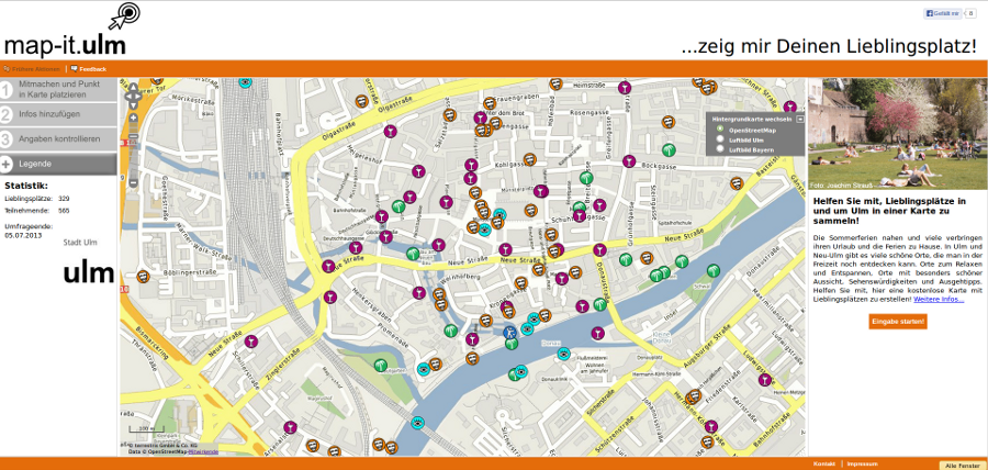
Since yesterday the geoportal “map-it.ulm” developed by terrestris, the planning agency Planungsbüro Geoinformation + Planung and the City of Ulm is online. The aim of this portal is to enable citizens to map their favourite places in and around Ulm in an easy fashion.
During the first 24 hours more than 200 locations were entered!
Here is the official press release issued by the Ulm city administration: (translated from German by terrestris)
Campaign to map favourite places in and around Ulm on a free map
In and around Ulm there are many pleasant places to discover in ones’ free time. The city of Ulm started the first round of participatory mapping on the internet scheduled to last 2 weeks under the motto “map-it.ulm”, where local citizen knowledge is sought. In a map you can pinpoint your favourite locations in predetermined categories.
Maps for citizens and tourists become better when many people add their local knowledge. This is the motivation behind the “map-it.ulm” campaign which has the target of creating a free map into which anybody can enter their favourite location in specified categories. With OpenStreetMap as the background map service map-it.ulm relies on another participatory mapping project that is successful all over the world. Besides an aerial image of Ulm we provide with OpenStreetMap another background data service that does not stop at the state border in the middle of the Danube river. “Favourite places are totally independant from administrative boundaries on paper”, says Lucia Erdt, director of the competence center Geoinformatics in the IT department of the City of Ulm.
Mayor Gunter Czisch is very enthusiastic about the idea of integrating the knowledge of many people into maps. “map-it.ulm” – these are maps where everybody can join in following the credo “by many for many” in and around Ulm. “Place a marker on the map, choose a category, write some text, done.” Even after the end of the campaign lasting 2 weeks the favourite places will be accessible for all trough the internet and the data will be made available to the public free of charge for further use.
Mayor Czisch is already one step ahead: The “map-it” campaign will become really interesting when citizens contribute their local knowledge to subjects that are highly dynamic or where no current digital maps are available. So it comes as no surprise that the administration is already planning the next participatory “map-it.ulm” campaign.
www.map-it.ulm.de
Contakt:
City of Ulm
Central Control – Team IT
Competence Center Geoinformation
Lucia Erdt
+49 731 161 1037
L (dot) Erdt (at) ulm (dot) de


