For several years, the Innovation Days at terrestris have been a permanent fixture in our calendar. On these days, also known internally as “game days”, the employees determine the content of their day themselves. Each employee considers in advance whether they would like to try something new or whether they would like to develop or test software or techniques.
Innovation Days are creative breaks from daily work and the success of this concept speaks for itself: some of our working methods, offers and features have their origins on one of these days. Today we report excerpts from the developments of the last Innovation Day in April:
React Native:
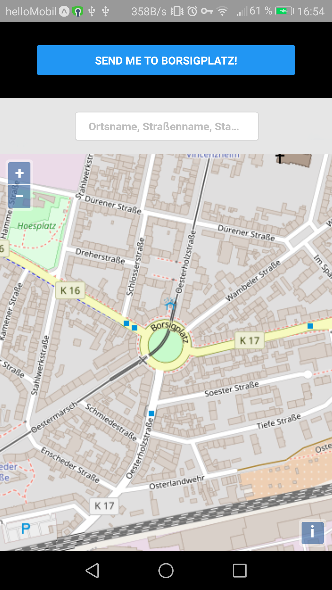
React Native is a JavaScript framework for creating native apps for Android, iOS and Windows based on the design concepts of React, which we use in many of our projects.
In this context, a simple app prototype was created, which in addition to React Native components (e.g. buttons) contains a WebView in which a fully functional react-geo application is integrated (see following figure). A specific goal was also to establish communication between these components (native UI components and map in WebView). This goal was successfully tested.
GitLab Registry:
The GitLab Registry is an internal registry for Docker Images. These are used in such a way that corresponding images are automatically created and published in the registry. These images can then be used, for example, to quickly start a current version of the project using Docker tools.
Nexus:
Nexus is a tool for managing registries, but also other repos. Nexus simplifies internal test system deployments, so that testing can be carried out more quickly, for example. You can also install this more quickly and conveniently at the respective customer, as you can simply download a new image from Nexus for this purpose. Overall, a very helpful addition to make repetitive workflows more pleasant and less prone to errors.
opendata.bonn:
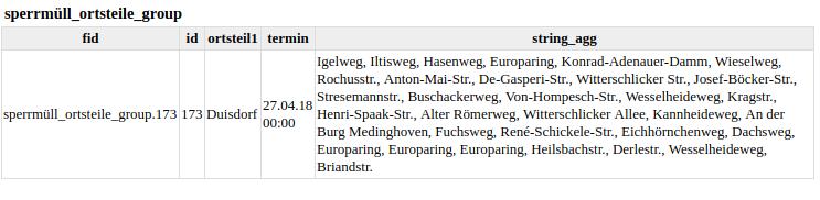
The term Open Data primarily describes the public administration’s own electronic data stocks, which are made available to external third parties in the interests of the general public with an open usage license for further free use. Excluded from this are personal data. For the Innovation Day, a CSV data set was selected that was not georeferenced and only contained the street names. This was then spatially located once with the Cologne-Bonn road network and once with the districts of Bonn and thus refined.
A script was then written which accepts a CSV and GeoJSON file as parameters, as well as column names for the ultimately resulting database JOIN. This automatically imports everything relevant into the database, merges the tables and thus attaches geometries. Specifically, the waste collection dates for 2018 were used and a map was created from the bulky waste data in GeoServer, which can be queried as WMS-Time.
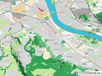
QGIS Time Manager:
The QGIS Time Manager Plugin enables the analysis and visualization of temporary geodata in QGIS. Both vector and raster data can be filtered temporally based on timestamp attributes and transformed into animation with just a few clicks. Under the term Geogiffery (Geography + animated gifs) there are many use cases on the net, ranging from animated natural disaster events (volcanic eruptions, earthquakes) to LULC-Change to visualization of everyday commuter flows in metropolitan areas.