SHOGun is a versatile framework from terrestris for creating modern WebGIS applications. It is specifically tailored to the requirements of companies, authorities and organizations. The focus is on the structured, secure and user-friendly handling of geodata – from visualization to processing. SHOGun provides the technical basis for not only making geodata available on the web, but also for making it productively usable.
The open source platform for modern and productive WebGIS applications with numerous functions
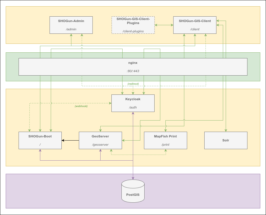
The architecture is multi-layered and modular. This creates a scalable and future-proof platform that can be flexibly adapted and is also suitable for growing user numbers or increasing data volumes. SHOGun also integrates seamlessly into existing IT infrastructures. Thanks to the consistent use of open source technologies and open standards, the solution remains open and independent.
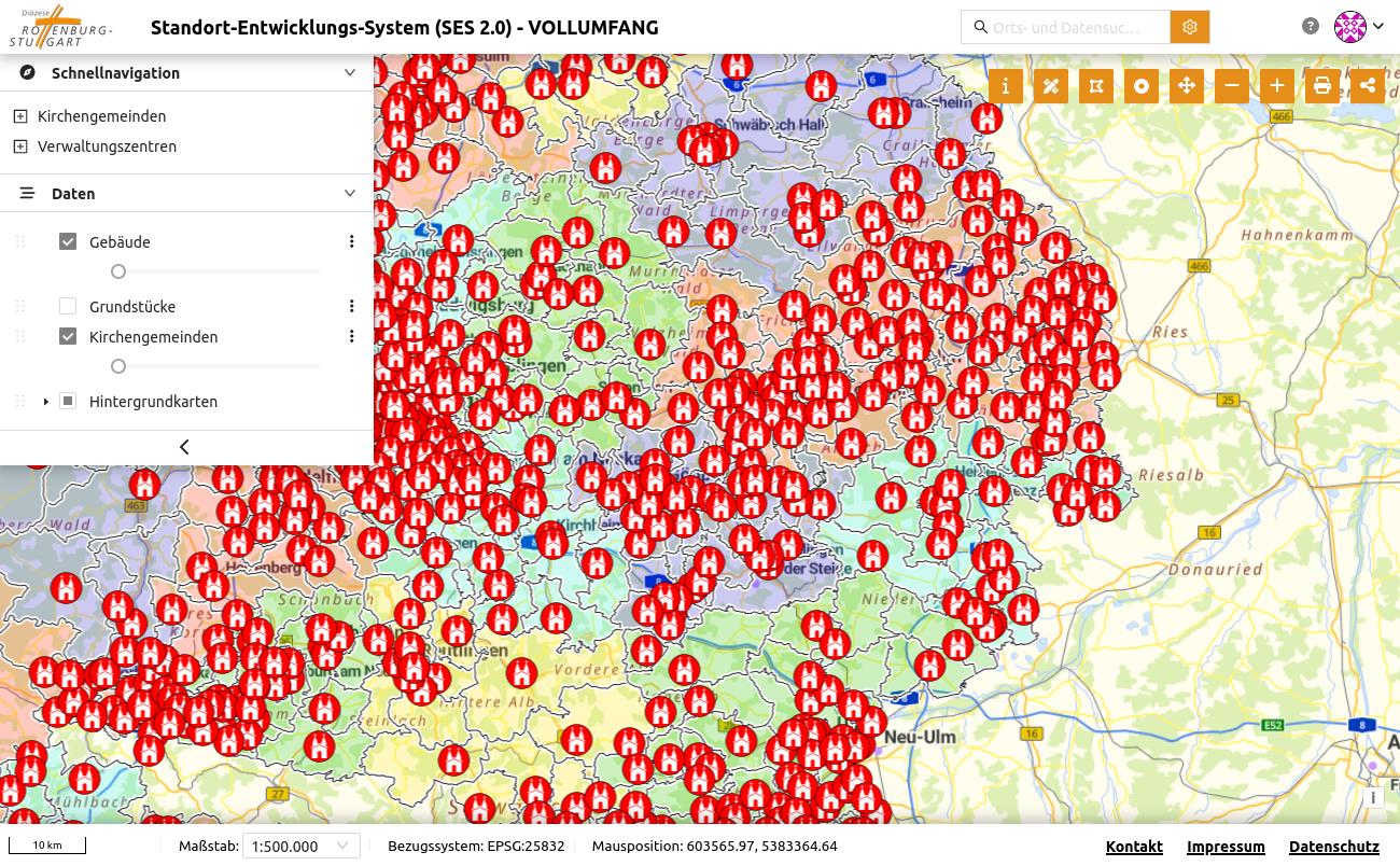
The browser-based client allows users without specific technical expertise to view and edit data directly on the web. The user interface can be configured individually depending on the role and rights model so that only the information and tools that should be displayed are shown.
Our services:
- Software setup
- Migration of existing applications
- Core development
- Development of individual extensions
- Consulting
- Training courses – standard or customized
- Support and maintenance
Advantages:
- Individual adjustments thanks to modular architecture
- Open Source – no license fees and full control over the software
- Intuitive and user-friendly interface incl. clear backend
- Easy integration into existing IT infrastructures
- OGC-compliant
A key feature of SHOGun is its modular structure. Numerous functions are already included in the standard scope. At the same time, components can be added, configured or developed for specific projects depending on the project requirements.
Differentiated role and rights management is of central importance when handling sensitive data. Access to data, functions and interface elements can be granularly controlled. This allows complex authorization concepts to be mapped and legal or organizational requirements to be reliably fulfilled.
Cloud-ready microservices – scalable, flexible and future-proof (e.g. deployment via Kubernetes)
SHOGun is technologically based on Spring Boot (incl. Spring Security) and Hibernate. The client uses modern web standards and established libraries such as OpenLayers for high-performance map display. Communication with the backend takes place via standardized interfaces (OpenAPI), optionally via GraphQL and REST.
The architecture consists of, among other things:
- PostgreSQL/PostGIS as database
- GeoServer for the provision of OGC-compliant services (e.g. WMS, WFS)
- Keycloak for rights and role management (a connection to SSO / LDAP / Active Directory is possible)
- MapFish Print for map export
The aim of SHOGun is to provide a scalable, expandable and interoperable platform for the provision and management of geodata on the web. The application is based entirely on open source technology and open standards such as those of the Open Geospatial Consortium (OGC).
Projects with SHOGun:
- Geoportal Spatial Planning Baden-Württemberg: https://terrestris.de/referenzen/geoportal-raumordnung-bawue/
- GeoData Architecture Rhineland-Palatinate: https://terrestris.de/referenzen/geodaten_architektur_reheinland_pfalz/
Links:
With us, you have an experienced partner at your side who will support you throughout the entire project – from the initial consultation to long-term support. Our team ensures that your application runs smoothly and is optimally tailored to your requirements.
Please contact us for a non-binding consultation.