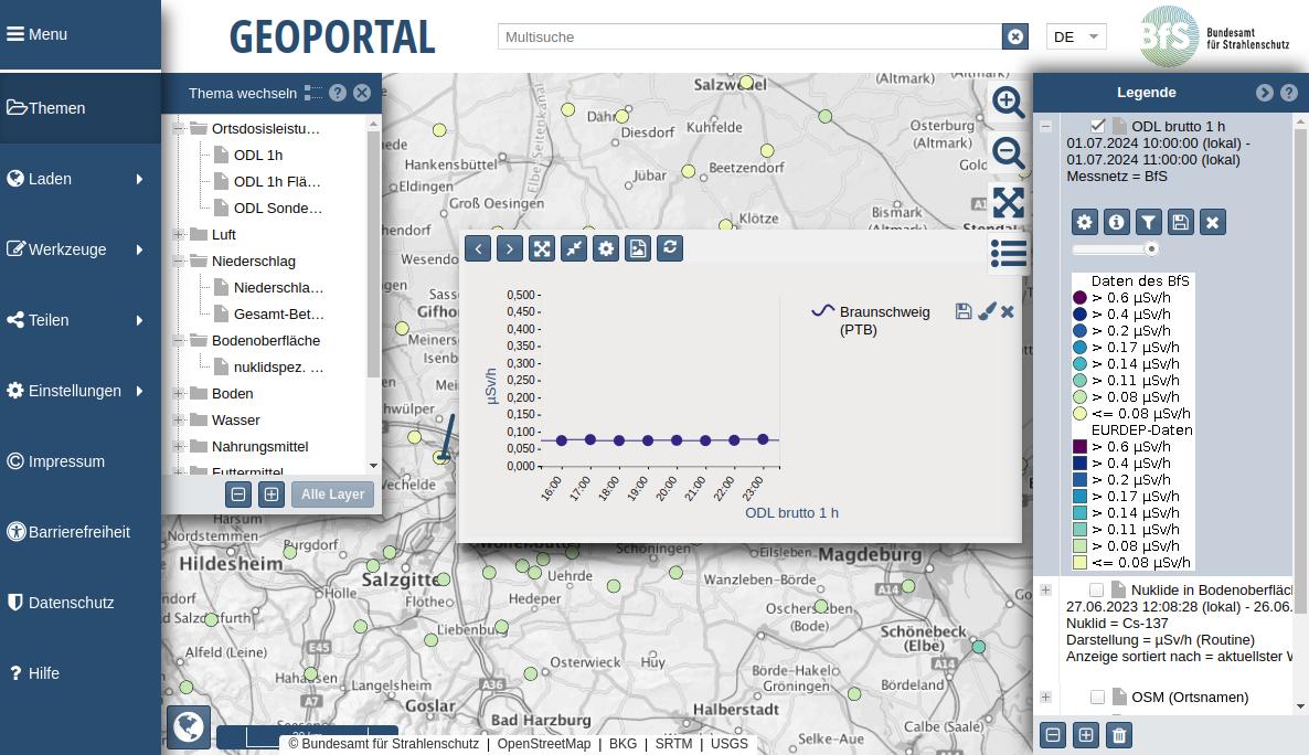
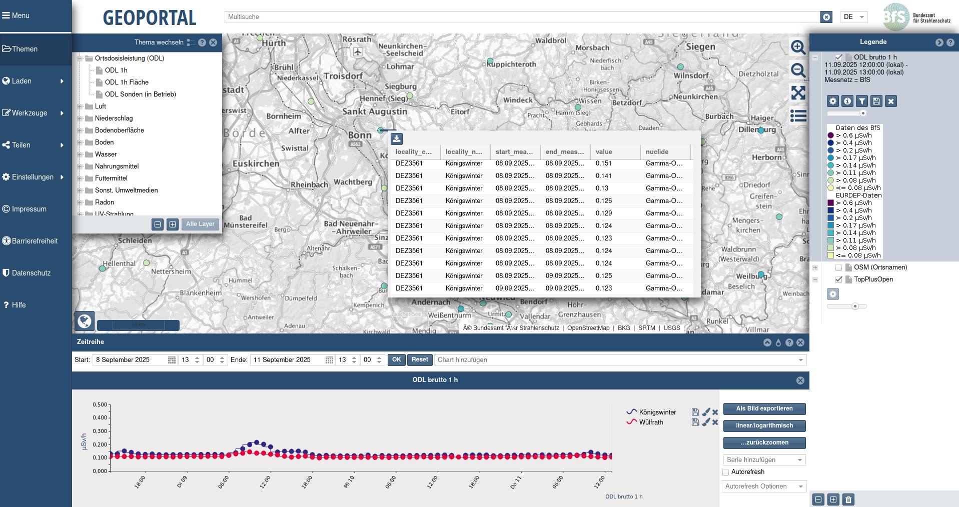
The Geoportal of the Federal Office for Radiation Protection combines user-friendliness with powerful functionality: It not only enables the targeted search, clear visualization and easy download of geodata, but also convinces with innovative tools such as interactive time series analyses and integrated routing. In this way, pure geoinformation becomes a versatile analysis instrument – intuitive to use and practical to apply.
Challenge
The task was to develop an innovative WebGIS solution that goes far beyond the mere presentation and findability of geodata. A powerful system was required that integrates complex functions such as interactive time series diagrams and intelligent routing. At the same time, the requirements for OGC compliance had to be met and the specific requirements of the BfS had to be taken into account in order to guarantee a modern, accessible and user-friendly application that is convincing both in terms of content and technology.
Services
The following measures were implemented to meet these requirements:
- Development of a WebGIS Client:
- Integration of GeoNetwork opensource (GNOS) for the management and provision of geodata and services.
- Connection of OGC-compliant map services with time information, which are displayed in interactive diagrams.
- Routing Integration:
- Implementation of classic routing and fleet routing based on the openroutservice.
- Calculation and visualization of the accessibility of surrounding locations, taking into account restricted areas.
- Accessibility:
- Implementation in accordance with the Ordinance on the Creation of Accessible Information Technology.
- Provision of alternative texts, keyboard control and avoidance of flashing content.
- Extension of functionalities:
- Development of an Apache Superset plug-in for visualizing data in diagrams on the map.
- Integration of OGC-compliant services with dynamic diagrams and coordinates.
- Project management:
- Conception of the application, development of the interfaces and responsibility for project, quality and release management.
Result
The BfS Geoportal offers a user-friendly solution for searching, displaying, and downloading geodata. The WebGIS application enables a dynamic visualization of time series and offers valuable tools for planning and analysis through the integrated routing. The OGC-compliant provision of the services as well as the innovative extension for diagram display on the map contribute to an efficient use of the geodata and ensure the long-term maintainability of the solution.
Customer
Federal Office for Radiation Protection