With GeoNetwork opensource, you can provide your geodata in a structured, searchable, and standards-compliant manner. The powerful catalog software helps municipalities, authorities, organizations, and companies to centrally manage and specifically provide geoinformation.
Easily manage and make metadata accessible centrally – based on open standards
GeoNetwork opensource offers powerful metadata editing and search functions as well as an interactive web map viewer. The design of the interface can be individually adapted through the use of Bootstrap Themes.
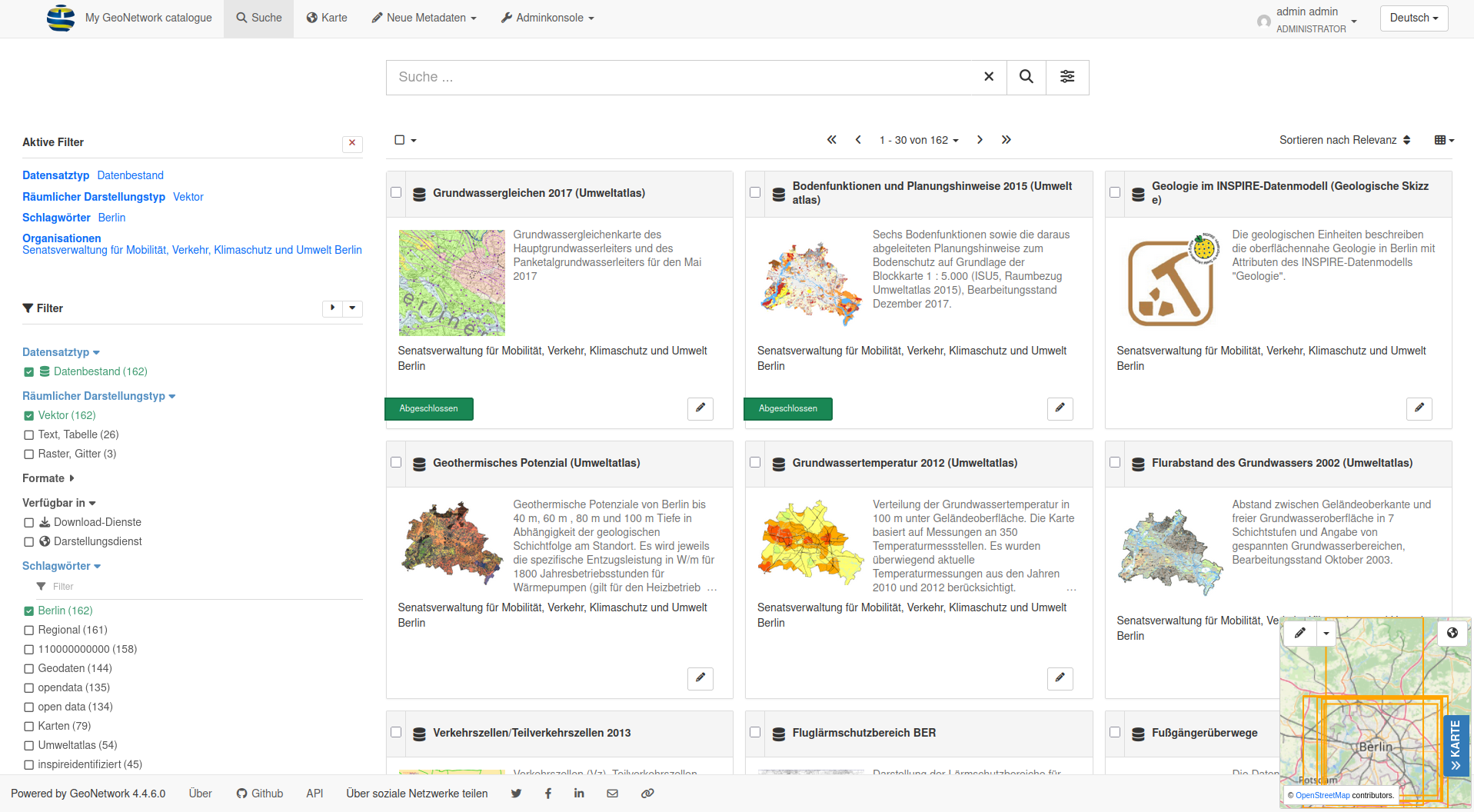
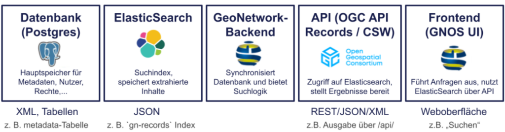
GeoNetwork supports the simple collection, maintenance, and publication of metadata for geodata and services. It is based on open standards such as ISO19115, ISO19119, INSPIRE, and OGC and offers extensive search functions, individual views, and interfaces for further processing. Both layers and services, maps, or non-geographic datasets can be described in the catalog. Templates and directories are available for this purpose.
Our services:
- Setup and configuration of GeoNetwork opensource
- Adaptation of metadata profiles (e.g. INSPIRE-compliant) through plugin mechanism
- Migration of existing metadata holdings
- Consulting
- Training courses and workshops
- Support and maintenance
Advantages of GeoNetwork:
- Standards-compliant metadata management
- Web-based interface for easy use
- Integration into existing IT infrastructures
- Extensive search functions
- Open Source – no license fees and full control over the software
The easy-to-use web interface enables the search for geodata in various catalogs. The search allows both a full-text search and a faceted search for keywords, resource types, organizations, scales, and much more.
GeoNetwork is part of the Open Source Geospatial Foundation (OSGeo) Software Stacks
An editor enables the uploading of data, graphics, documents, PDF files, and many other file types. Among other things, multilingual editing of metadata, a validation system, and the generation of suggestions for improving metadata quality are supported.
The interactive map viewer based on OpenLayers also offers access to OGC services (WMS, WMTS) and standards such as KML and OWS. In conjunction with the catalog, new services, layers, and even dynamic maps can be found and combined with each other.
Contact us – we will be happy to advise you on possible applications, implementation strategies, and individual extensions relating to GeoNetwork opensource. We support you in integrating Geonetwork into your geodata infrastructure or into existing environments.
GeoNetwork also benefits from a dedicated community that continuously contributes to the further development and improvement of the software. A direct insight into the current development status as well as the source code is available in the official GitHub Repository.