The GeoStyler is an OpenSource React library that enables the creation of flexible and powerful graphical user interfaces for map styling in the browser. With a user-friendly API and a client for converting between various open styling formats, GeoStyler offers a solution that integrates seamlessly into any website.
OpenSource React library for map styling on the web
GeoStyler is all about styling maps. You may be looking for UI components to create custom and flexible styling widgets for your geodata application. Perhaps you are trying to transfer the style you have worked so hard on in your favorite (Q)GIS to the web. GeoStyler helps with exactly these problems.
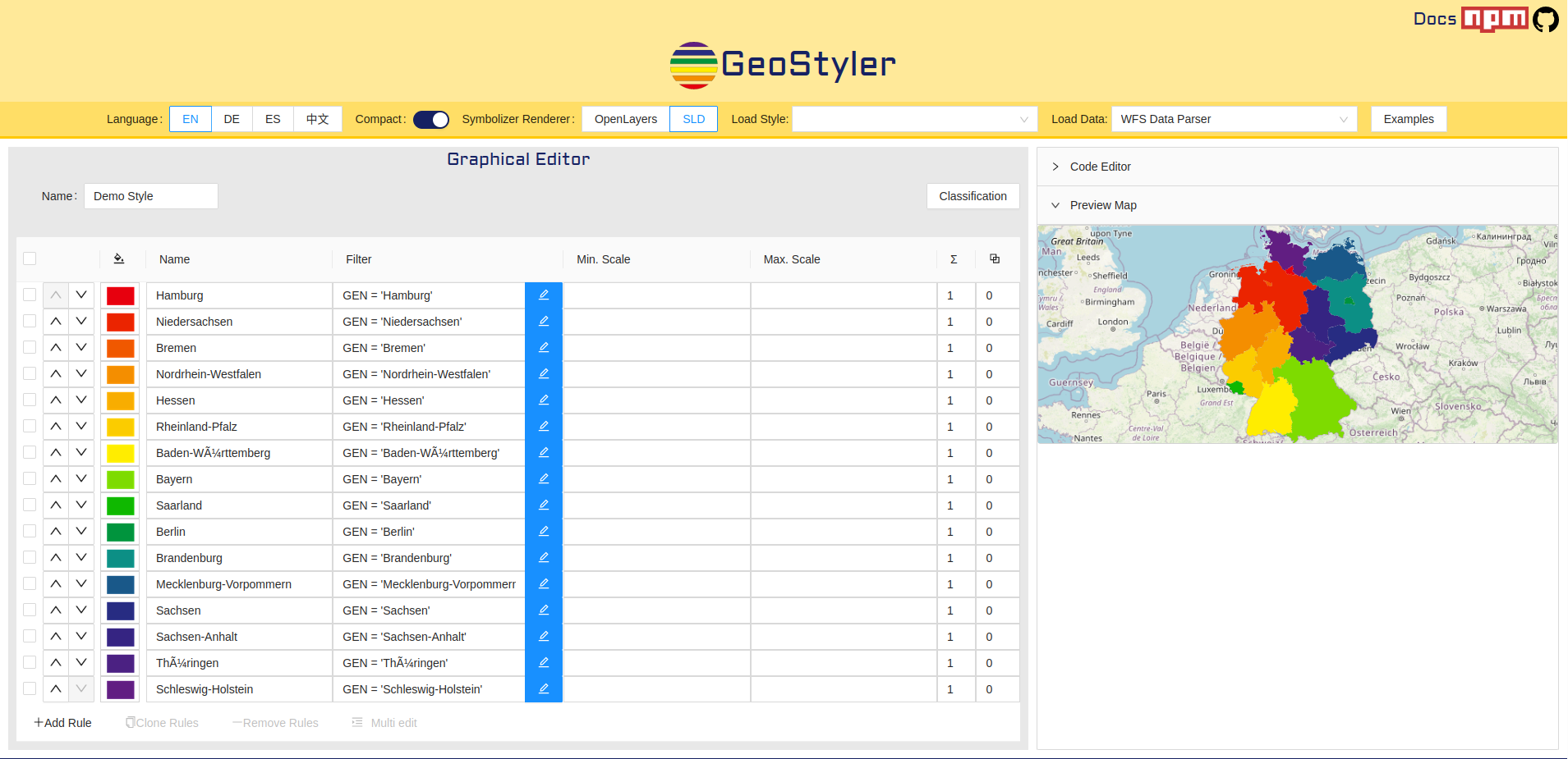
A central element is the React library, which provides widgets and tools for creating flexible UI components. This allows you to build simple applications for your website. We now use GeoStyler in numerous projects and have even integrated it into our in-house WebGIS SHOGun.
Since we at terrestris are among the core developers of GeoStyler, we actively participate in the community and promote its continuous development – e.g. through participation in regularly held code sprints.
Our services:
- Support with integration and application
- Development of new parsers to support further styling formats
- Advancing the OpenSource project
- Daily use in a variety of projects; including part of our SHOGun Stack
Advantages of GeoStyler:
- Seamless integration
- No commitment to a specific format
- Easy conversion between styles
- Easy customization of UI components
- GeoStyler-UI, style parser and client: Use what you need
- Conversion via the command line
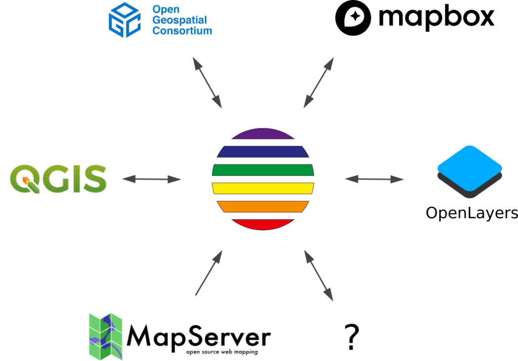
GeoStyler supports numerous style formats: QML from QGIS, Mapbox JSON, which is used in MapLibre, OpenLayers Styling Format and the OGC-standardized SLD format, which is used by Geoserver. Recently, the Esri Layer File format is even supported. Each of these formats can be converted into one of the others. Each style parser is provided as a separate Github repository and NPM package. An overview of the available style parsers and links can be found here. Styles can be converted either with JavaScript in your application or with the GeoStyler command line interface (CLI). With the CLI, both individual style files and entire directories can be converted from one of the supported formats to another.
Diverse style formats thanks to a variety of parsers
Originally, the project arose from the recurring challenge of developing individual UIs for styling layers and map services in our projects. This gave rise to the idea of creating an independent tool that can be flexibly integrated into a wide variety of projects.
This idea has now become an official OSGeo community project, which is continuously being developed by a dedicated community. We are pleased that GeoStyler is being used more and more.
Interested in the project? The project provides a demo application and here goes to the website. Otherwise, we will be happy to help you with your styling requirements and advise you on any questions or problems.
Simply contact us for a non-binding consultation.