With the Open Source Project Masterportal, you can bring your geodata to the web without a lot of overhead and, if desired, integrate it directly into your website. Whether for municipalities, companies or institutions – the Masterportal offers a user-friendly map application that is flexible, powerful and individually customizable.
Provide geoinformation simply and flexibly on the client side
The Masterportal is primarily developed by the administration for the administration, but is also supported by various service providers. As a framework contract partner of dataport, we are significantly involved. With the data acquisition add-on developed by terrestris, it is now also possible to integrate forms into the Masterportal (see Kreis Warendorf for more details).
The Masterportal is an open source WebGIS platform that has been specially developed for the requirements of modern geodata applications. It serves as a geoportal for providing both 2D and 3D administrative information (e.g. parcels of land, development plans, aerial photos, public transport, electric charging stations or building stock). It also offers functionalities for an extensive specialist portal for the management of spatial planning with login, data processing and evaluation.
The Masterportal offers versatile core functionalities to reach your goal quickly and efficiently. This is complemented by a well thought-out add-on concept that enables the integration of new tools, GetFeatureInfo topics or search backends.
Our services:
- Setting up the Masterportal software
- Migration of existing applications
- Core development
- Development of individual add-ons
- Consulting
- Training courses – standard or customized
- Support and maintenance
Advantages of the Masterportal:
- Individual adjustments thanks to modular architecture
- Open Source – no license fees and full control over the software
- Intuitive and user-friendly interface
- Easy integration into existing IT infrastructures
- OGC-compliant
The Masterportal is based on proven open source technologies and enables the easy integration and display of geodata in interactive map applications. Thanks to its modular architecture and high adaptability, the Masterportal is the ideal choice if you want to manage and present your geodata efficiently.
The WebGIS from the administration for the administration
The Masterportal project was created through the cooperation of various public administrations, supported by various service providers, for a common solution for the visualization and provision of geodata. The development is constantly being driven forward and we, as a framework contract partner of dataport, are significantly involved in this. The versatility of the Masterportal is complemented by an extensive add-on concept, which enables the integration of new tools, GetFeatureInfo topics or search backends.
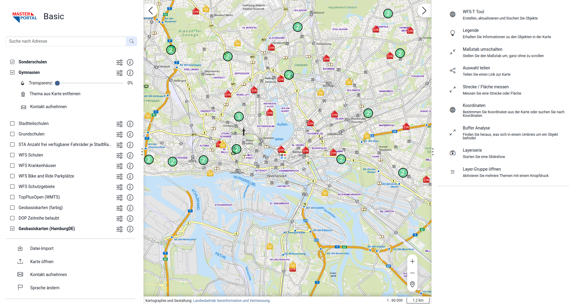
Features (selection):
- Print function
- PDF Export
- Login (backend is a prerequisite)
- WFS search incl. filter tool
- Internationalization (i18n)
- 3D display with Cesium (e.g. for city models, terrain models)
- News Module
- Feature-rich filter tool for WFS (e.g. buffer analysis for calculating radii around geometries)
- Routing (BKG Backend)
- Diverse interfaces (including WFS-T, Sensor Things API, OGC Feature API, WMS Time)
- Multi-search through multiple search backends, including Komoot, OSM, Elastic Search, WFS, BKG Gazetteer)
- Shadows for 3D buildings
- Time Slider
more at Masterportal-Features
Addons (selection):
- Oblique aerial photos
- Geodata Export and Importer
- School route routing
- DetailSearch (with metadata result display)
- Height measurement including creation of height profiles
- Metadata Explorer (see MDI-DE)
- Data acquisition add-on (see Kreis Warendorf)
- GFI Theme sensor data for the display of sensor data
more at Masterportal-Addons
Application
With us, you have an experienced partner at your side who will support you throughout the entire project – from the initial consultation to long-term support. Our team ensures that your application runs smoothly and is optimally tailored to your requirements.
Contact us for a non-binding consultation and find out how the Masterportal can make your geodata more efficient.