In the middle of the year, terrestris will be 20 years old. We would like to take this as an opportunity to bring important events and projects out of the darkness of the past and put them back in the spotlight many years later. In today’s article in this series, we want to look back at the development of our active participation in the Open Source Geo-Community over the last 20 years.
If, like us, you have made the use and distribution of open source software your mission, there is no alternative to developing or participating in a heterogeneous and vibrant community around the open source projects used. That is why we have been attending conferences and code sprints since our early days and have been involved in organizing conferences and other community events ourselves.
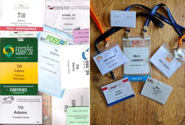 Till Adams took over the bulk of such events in the early days: “My first international conference took me to the ‘OSG’ (Open Source for Geo) in Minneapolis in 2005, the place where a certain Steve Lime at the university had developed the software UMN MapServer. The OSG was the precursor conference to the “FOSS4G” conference (Free & Open Source Software 4 Geospatial), which has been held annually since 2006. At that time, we were already using components such as PostGIS, UMN MapServer and QGIS Open in our projects and the projects mentioned were already lighthouse projects of the Open Source Community. For that reason alone, it was an impressive experience to get to know Steve Lime or Daniel Morrissette (UMN MapServer), Paul Ramsey (PostGIS) or Gary Sherman (QGIS) personally, the very people who were and in some cases still are largely responsible for the development of these projects.”
After that, FOSS4G took us to almost every continent and one thing is certain: In 20 years of company history, quite a few travel kilometers come together. But also at the German-speaking level, a lot has happened since 2003: Torsten Brassat, then an employee of the Bonn Geo-Consortium and now Managing Director at terrestris, Arnulf Christl, founder of the company CCGIS and today Agile Coach at terrestris and myself, co-founder of terrestris, sat in their Bonn local pub and decided to organize the 1st ‘UMN MapServer User Conference‘ in Bonn. The short “dispute” with our colleague Jörg Thomsen (today President of FOSSGIS e.V.), who with his company mapmedia had already organized a UMN MapServer User Conference in Berlin a few months earlier, about those who organized the first conference, we soon settled over a beer. The earlier date of the Berlin conference was compensated by the much higher number of participants at the conference organized by us – we easily won this “competition” with 90:20. In the following years, the UMN User Conference became the FOSSGIS Conference and the already existing association “GRASS Anwendervereinigung” became the FOSSGIS e.V.. Today, the FOSSGIS Conference has several hundred participants every year and is an indispensable part of our event calendar in the German-speaking area.
 A characteristic of open source projects are so-called code sprints, developer meetings where the developers of the software come together to develop it further. In addition to participating in various code sprints, we have repeatedly hosted code sprints in our premises, for GeoExt, OpenLayers or most recently also for GeoStyler.
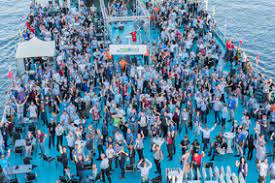
One event is of course particularly memorable: the FOSS4G 2016 in Bonn. Officially, the conference was organized by FOSSGIS e.V., but terrestris put a lot of resources into the almost one-year preparation period. On the days of the event, everything was right and the weather played along as well. In addition to the actual conference, a one-week code sprint was held at BaseCamp Bonn, there was a B2B conference, workshops, a reception in the old Bonn City Hall and of course our evening social event at the “Rhein Energy”. In total, almost 1000 participants registered for the events surrounding the conference.