![]()
The number of contributors to the global free WIKI world map is increasing daily. Nevertheless, for many, the entry hurdle is still relatively high, or they simply lack the time to delve into OpenStreetMap in detail.
OpenStreetMap benefits greatly from people knowing their local environment best and being willing to share their knowledge with the community in the form of OpenStreetMap contributions.
The app “StreetComplete”, which is also available in the preferred Android app store, offers a very simple entry point. StreetComplete asks the user questions about not fully recorded objects around the current location (provided that the GPS is switched on and has been enabled for the app). The only thing needed besides the app is your own OpenStreetMap Account. Because all the questions you answer are transferred to OpenStreetMap under the username of the person answering.
Once installed and logged in, participating is really fun. Our terrestris founder, Till Adams, uses the app for his own fitness. Because the circles around his own place of residence, which he has to jog to reach different parts of town where there is still something to do, are getting bigger and bigger.
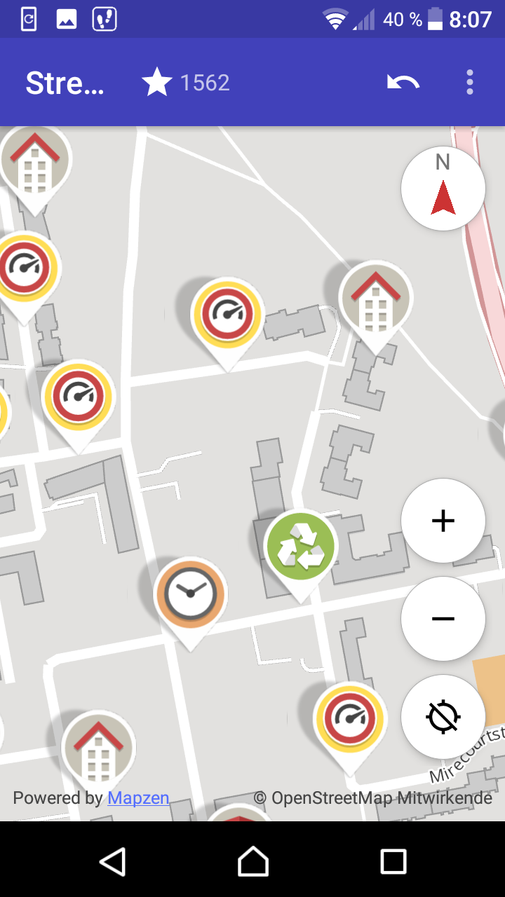
The figure shows a screenshot of the app with a number of questions. Each question opens in the lower area as soon as you tap it with your finger.
In the following, we have compiled a few examples for you:
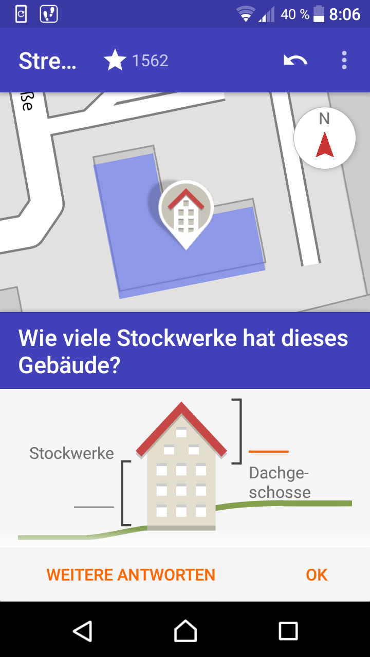
Number of floors of buildings
The number of floors is interesting for many applications. Be it for 3D applications, because building heights can of course also be roughly extracted from the number of floors, or for many geomarketing applications.
The figure above shows the map with the corresponding symbol and the highlighted object in question. The GPS position usually helps with identification. Below, you enter the number of floors on the left and the number of attic floors on the right.
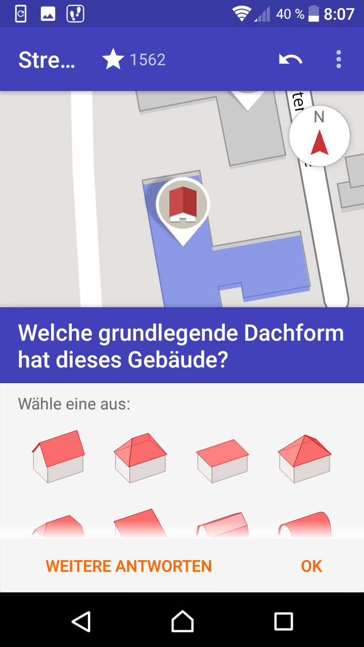
Roof shape
Often, after you have entered the number of floors, the question about the roof shape appears on the same building. This also serves the 3D representation of OpenStreetMap data.
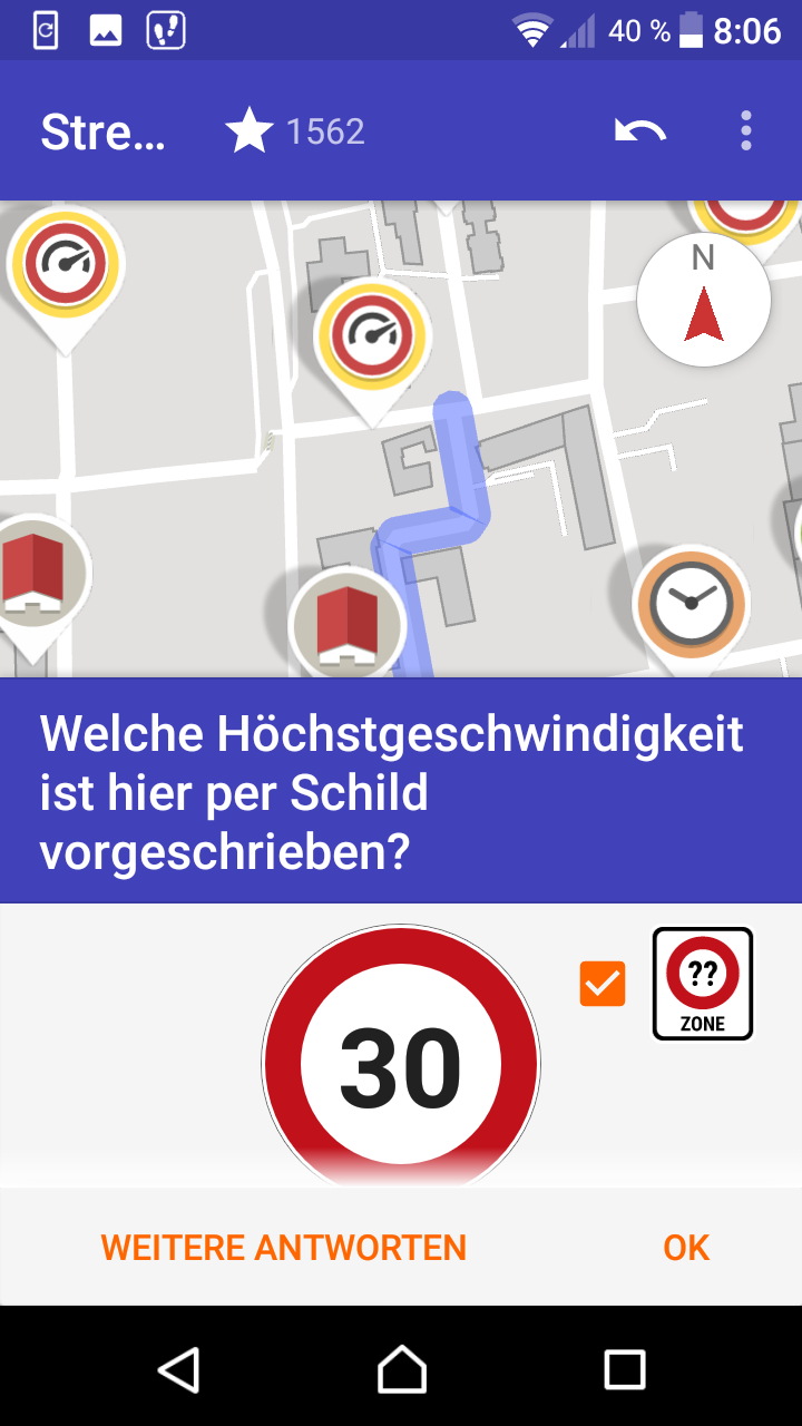
Speed
For all questions related to routing, maximum speeds are of interest. Often, however, these are not entered. A checkbox, as can be seen in the figure, automatically fills in the “30 km/h” for 30 zones.
There are a number of other tasks such as the opening hours of shops or road surfaces. Sometimes you can be happy about real “exotics”, such as the questions of whether a road is lit, whether cycle paths exist or the type of fruit cultivated on an area.
terrestris founder Till Adams likes to make these entries while jogging. This distracts him from running, expands the running radius and thus contributes not only to the improvement of OpenStreetMap, but also to the improvement of his own condition. One could also describe it as a classic win-win situation.
Via Github you can get in touch with other developers very well, who are developing the app very dynamically. From the outside, it is an active community that reacts quickly to inquiries. The fact that no advertising is displayed is now almost a rarity and very pleasant.
The attentive user will certainly come up with one or two suggestions for improvement. In this case, it is always possible to contact one of the developers. If in doubt, there is of course always the option of using one of the better-known OpenStreetMap editors.