As part of the Master’s program in Geography at the University of Bonn, the 3rd semester is intended to gather practical experience in business or science, depending on interest. Since I had already worked extensively with Open Source GIS software and tools during my studies, as a student assistant, and in private projects, the opportunity to deepen and expand my knowledge in the context of an internship at terrestris seemed extremely promising. I had previously noticed terrestris as an active company in Bonn through its involvement in the Open Source GIS community.
The first few weeks were dominated by the upcoming FOSSGIS conference in Bonn, where users and developers of Free and Open Source GIS software from the German-speaking area come together to exchange information about the latest developments and challenges. terrestris presented workshops and lectures on various topics from the field of web mapping and geodata management. Since I was initially familiarizing myself with GeoServer and OGC standards at the beginning of the internship, I was able to help with the design of some workshops in parallel.
During the conference, in addition to my activities as a conference helper, I had the opportunity to listen to interesting lectures, which also gave me inspiration for my later internship project. In the breaks and at the social events, there was also plenty of opportunity to exchange ideas with other GIS professionals from application and research.
After familiarizing myself with the basics and common development tools, I began my internship project, for which I analyzed and processed free geodata from various sources in the following months and ultimately merged it into an interactive WebGIS with the help of a variety of open source tools and libraries. I came up with the idea of developing a circular route planner for bicycles after a few detours (e.g. “kiosk tour planner”) together with my internship supervisor Daniel Koch.
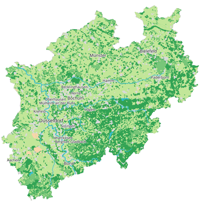
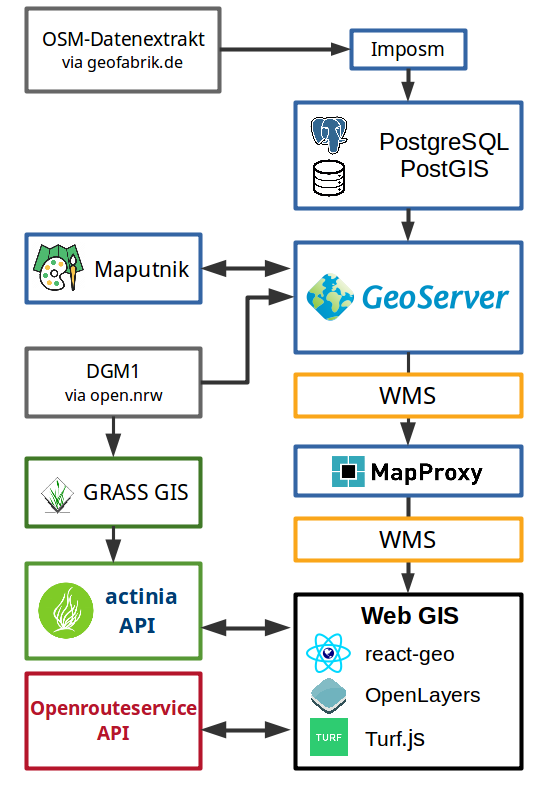
The initial idea was to develop a map style that is specifically tailored to the needs of cyclists. For this purpose, an OpenStreetMap data extract from North Rhine-Westphalia was first imported into a PostgreSQL database. In the second step, the data was distributed using GeoServer, first as vector tiles for designing the map style with the Maputnik editor, and then as a WMS service for integration into the WebGIS.
A challenge when using many different tools is always interoperability. In the GIS area, this is rarely a problem with OGC-compliant software thanks to many established standards. However, there were some problems, for example, when converting the Mapbox GL style format, which Maputnik uses, into the SLD format (OGC standard and used by GeoServer).
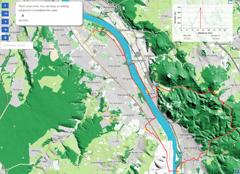
After the map style was finished, I looked at various open source routing services and existing cycle route planners and identified two central deficits, which ultimately gave rise to the ideas for the WebGIS. In the interaction of OpenLayers, Turf.js and the Openrouteservice API, the application makes it possible to quickly and easily create a circular route and then download it in GPX format. In addition, the Digital Terrain Model (DGM1) NRW is used to calculate the elevation profile, which has a height accuracy of +/- 20 cm and is therefore many times more accurate than the standard model (SRMT-1). The calculation of the height information runs via actinia, a newly developed cloud geoprocessing service of the partner company mundialis.
Click here for the application: https://github.com/hblitza/bike_round_trip
While programming with ES6 (modern JavaScript standard) and especially React.js was still quite bumpy at the beginning of the internship, I quickly gained confidence through daily learning by doing and a lot of support from the other developers. The WebGIS libraries OpenLayers and Turf.js offer numerous possibilities to process and visualize geodata in the browser. I found the numerous well-documented examples and the possibility to contact other users or even developers directly via forums and the developer platform GitHub to be particularly positive. Any deficits of open source tools can therefore be addressed directly and, if necessary, suggestions for improvement can be made.
During the daily morning meetings and forums, I gradually gained an insight into the everyday working world and corporate culture of terrestris and the partner company mundialis. After I presented my project to the other employees, many other ideas emerged, including the inclusion of actinia, a cloud geoprocessing service.
All in all, I really enjoyed my time at terrestris, which is not only due to the use of innovative and modern open source tools and what I consider to be a professional way of working, but also to the relaxed atmosphere, which I was able to experience, among other things, at the summer festival “Bratwurst, Bier & GIS”. I would like to thank all employees of terrestris and mundialis for the nice internship and look forward to visiting you more often as part of my master thesis!