^

Geoportal Spatial Planning Baden-Württemberg

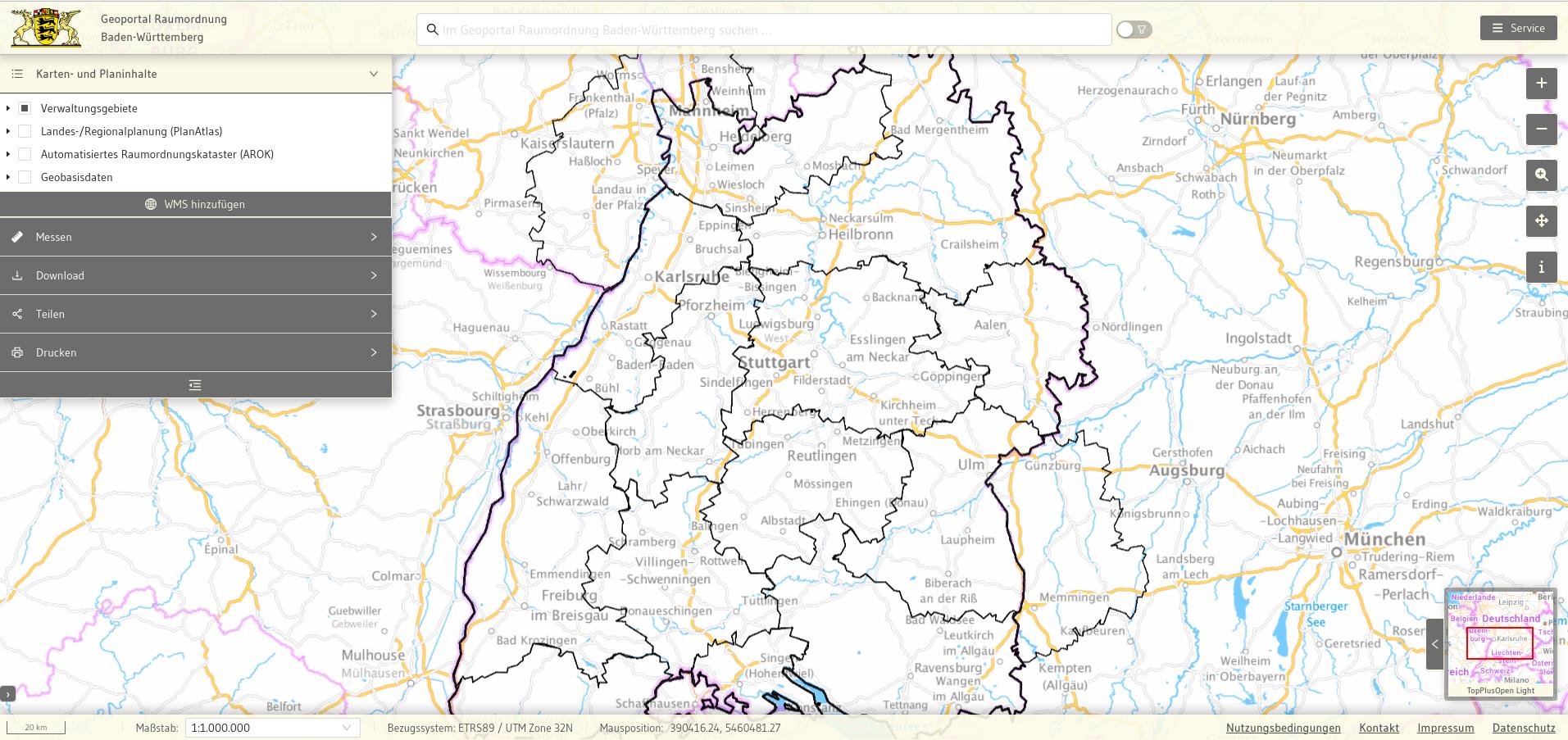
The Geoportal Spatial Planning is the central access point for the geodata of state planning, regional planning and municipal land-use planning in Baden-Württemberg. It enables both the public and authorities to have modern and efficient access to relevant planning data. With a clear focus on user-friendliness, accessibility and technological sustainability, the portal represents a future-oriented solution for digital geodata management.

Challenge

The project had to meet the needs of public users as well as the requirements of authorized authorities. For the public, the aim was to create an intuitive WebGIS that offers not only standard functions but also a powerful index search and download options. At the same time, the system had to provide a data management component for authorities, with which spatial planning data and metadata can be uploaded and maintained. Particular emphasis was placed on accessibility, compatibility with all device types and compliance with extensive legal and technical standards, including WCAG, BITV 2.0 and EU directives. In addition, a service life of at least 10 years was aimed for, which placed high demands on the maintainability, scalability and technical flexibility of the system.

Services

  • Development of a modern WebGIS client:
    • Implementation of standard functions as well as an index search based on Apache SolR and a download component for downloading planning data in various formats.
    • Focus on accessibility and user-friendliness according to WCAG, BITV 2.0 and other EU regulations.
  • Integration of data formats and standards:
    • Support of the original model (PlanAtlas, AROK) and XPlanung compatibility.
  • Implementation of a data management component:
    • Enabling the upload and maintenance of spatial planning data and metadata by authorized users.
  • Sustainable system development:
    • Component-based structure for easy maintenance and further development.
    • Fully automated deployment to ensure smooth operation.
  • Long-term maintenance and further development:
    • Consideration of developing standards (e.g. OGC API, INSPIRE) as well as future browser versions.

Result

The Geoportal Spatial Planning Baden-Württemberg combines powerful functions, accessibility and technical flexibility in a modern, future-proof platform. Public users benefit from intuitive operation and versatile functions, while authorities receive comprehensive options for data maintenance and management. Thanks to the sustainable architecture and automated processes, the portal is optimally designed for technological developments and long-term operation.

The project sets standards for geodata portals and shows how complex requirements can be successfully implemented in a user-friendly and accessible solution.

Customer

Ministry of Regional Development and Housing Baden-Württemberg

Link

https://www.geoportal-raumordnung-bw.de/client

Geoportal Spatial Planning Baden-Württemberg

The Geoportal Spatial Planning Baden-Württemberg enables the summarized digital provision and presentation of geodata from the fields of state, regional and Automated Spatial Planning Cadastre (AROK). The data is available for free download both in the Geo-Data format Shape and in the nationwide data exchange format XPlanung.

Challenge

The project had to meet the needs of public users as well as the requirements of authorized authorities. For the public, the aim was to create an intuitive WebGIS that offers not only standard functions but also a powerful index search and download options. At the same time, the system had to provide a data management component for authorities, with which spatial planning data and metadata can be uploaded and maintained. Particular emphasis was placed on accessibility, compatibility with all device types and compliance with extensive legal and technical standards, including WCAG, BITV 2.0 and EU directives. In addition, a service life of at least 10 years was aimed for, which placed high demands on the maintainability, scalability and technical flexibility of the system.

Result

The Geoportal Spatial Planning Baden-Württemberg combines powerful functions, accessibility and technical flexibility in a modern, future-proof platform. Public users benefit from intuitive operation and versatile functions, while authorities receive comprehensive options for data maintenance and management. Thanks to the sustainable architecture and automated processes, the portal is optimally designed for technological developments and long-term operation.

The project sets standards for geodata portals and shows how complex requirements can be successfully implemented in a user-friendly and accessible solution.

Services
  • Development of a modern WebGIS client:
    • Implementation of standard functions as well as an index search based on Apache SolR and a component for downloading planning data in various formats.
    • Focus on accessibility and user-friendliness according to WCAG, BITV 2.0 and other EU regulations.
  • Integration of data formats and standards:
    • Support of the original model (PlanAtlas, AROK) and XPlanung compatibility.
  • Implementation of a data management component:
    • Enabling the upload and maintenance of spatial planning data and metadata by authorized users.
  • Sustainable system development:
    • Component-based structure for easy maintenance and further development.
    • Fully automated deployment to ensure smooth operation.
  • Long-term maintenance and further development:
    • Consideration of developing standards (e.g. OGC API, INSPIRE) as well as future browser versions.

Story