The Apache Superset project, which operates under the Apache Software Foundation, is one of the most popular open source solutions in the field of business intelligence and dashboards. The platform enables the analysis and evaluation of your own business processes using a user-friendly, intuitive interface.
Apache Superset – a business intelligence platform for data exploration and analysis
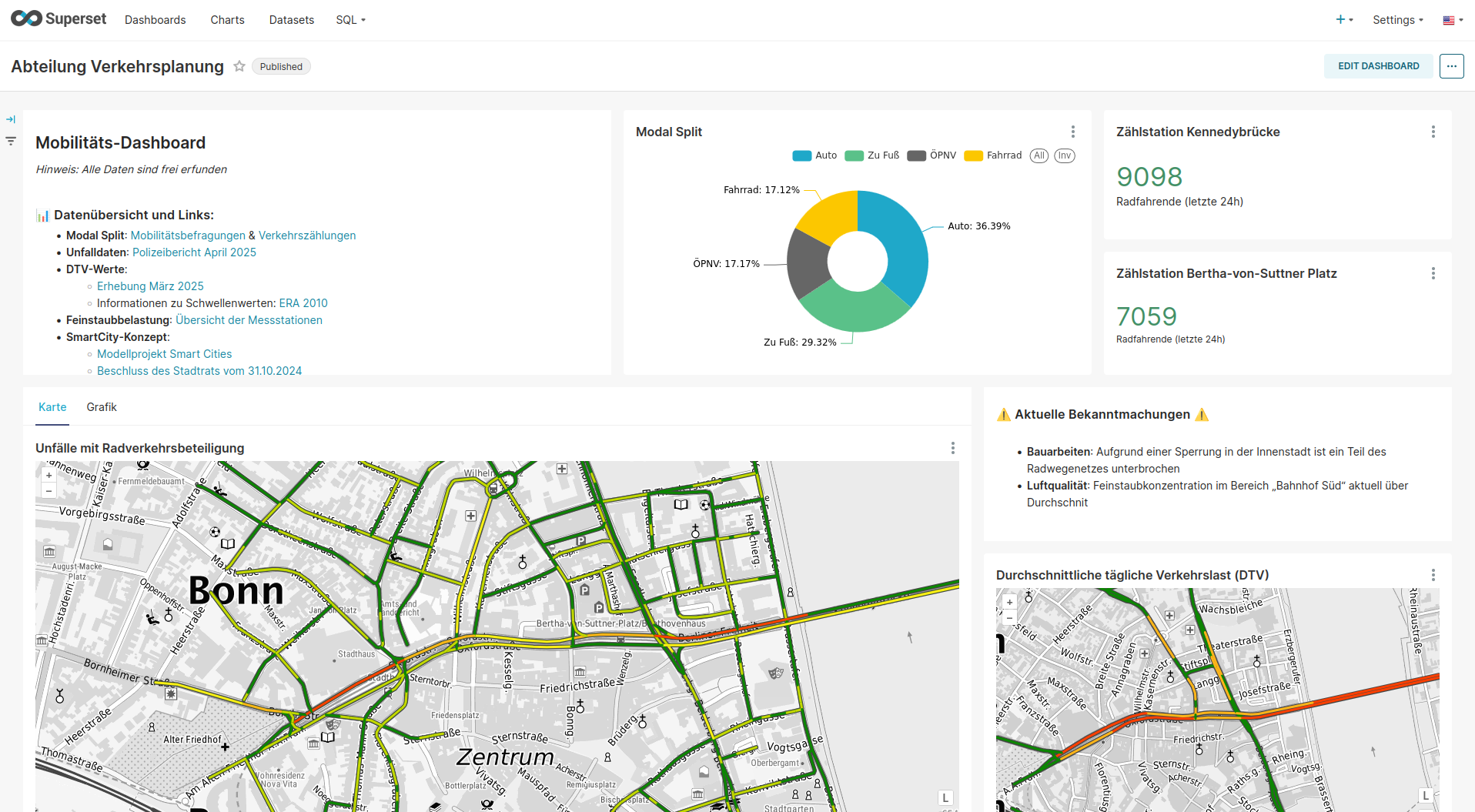
With Superset, you can easily integrate your own data sources and display them in a variety of ways. Using specially developed plugins, for example, geodata can be visualized both as thematic maps and as cartodiagrams.
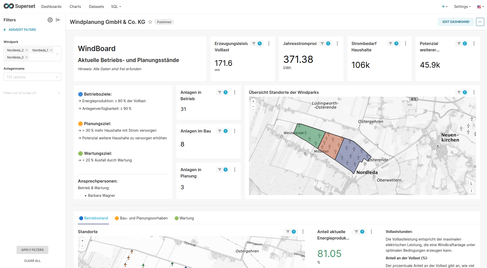
Superset enables the integration of classic bar and line diagrams as well as the more complicated display of heatmaps or pivot tables. Thanks to the extensive visualization options, thematically related data can provide insights into your own business processes. Superset can therefore be used as an internal analysis tool, as well as an external information platform – for example, in the municipal context of smart cities. Here, Superset can be used as a useful tool for participatory approaches and processes.
Our services:
- Setting up Apache Superset
- Migration of existing data
- Core development
- Development of individual add-ons
- Consulting
- Training courses – standard or customized
- Support and maintenance
Advantages of Superset:
- Easy to create individual dashboards without programming knowledge
- Open Source – no license fees and full control over your software
- Intuitive and user-friendly interface
- Easy integration into existing IT infrastructures
- OGC-compliant
The possible applications of Superset are versatile and are based on the needs of the users – whether in companies, in administration or in research. Areas of application include the analysis of environmental data, traffic flows, construction progress, production figures and much more.
As an active part of the Open Source Community, terrestris is driving Superset forward and contributing to the further development of the platform. The aim is to further improve the use of spatial and time-related data.
Our further developments:
The Cartodiagram Plugin enables the creation of cartodiagrams – diagrams that are georeferenced on a map. All diagram types supported in Superset are available, from simple pie charts to bar charts to line diagrams and more. In addition, typical cartographic adjustments can be made. These include, for example, the scale-related definition of the diagram sizes and also the addition of background maps, as well as their styling using GeoStyler.
The Thematic Map Plugin enables the creation of thematic maps. Areas such as countries and regions, lines such as house outlines and streets or points can be colored or otherwise visualized based on certain data values. The styling can be done, for example, on the basis of classifications or continuous values and is implemented using GeoStyler.
Thanks to the support of different projections, differently referenced data can be used.
And currently?
The following further developments are currently underway:
- Integrate WFS as a data source
- Enable cross-filter for Thematic Map Plugin
- Publication of existing developments
Do you have your own further development ideas? We also implement individual requirements and adaptation requests.
Here are a few suggestions for further developments to make Superset even more efficient and versatile:
- Enable SensorThingsAPI as a data source
- Enable OGC API Features as a data source
- Integrate OGC API Tiles as a background map
- Support metrics in the Thematic Map Plugin
- Improvement of the UX with Thematic Map Plugin
Contact us for a non-binding consultation.