![]()
Game days already have a tradition of several years at terrestris and mundialis. In the future, we will report on these game days here.
However, this is not a Bundesliga review, as one might commonly think, but a report about a working day that the employees can design according to their wishes. Game days usually take place once a month and serve to work on products and ideas for the companies without being tied to projects, or to improve existing projects or products, or to try out new techniques for which there is no room in day-to-day business.
OpenStreetMap & topographic WMS
terrestris has been providing a freely usable map service based on OpenStreetMap data as WMS for over four years. So far, our service has always had the weakness that we had to import a complete OSM world file every week and recalculate all existing caches.
As a result, we were unable to offer the usual performance for the service, especially on weekends.
As part of the game day, our software stack was updated. This now makes it possible to import only so-called diff files, i.e. only changes, with the data import. The change information is stored in such a way that only the tiles that have changed are re-cached. After the official activation, we can thus offer a service based on data that is up-to-date. We also see this as an important milestone towards our targeted premium OSM service, which we want to offer with a guarantee of availability.
In addition, work was carried out to replace the elevation model underlying our Topo-WMS service. Previously, data with a ground resolution of 90-500m was used for this purpose; in the future, this will be completely replaced by the significantly higher-resolution NASA-SRTM30 data, which has a ground resolution of 30 meters. Together with the updated Topo service, a new layer, a shaded relief, will soon be available for free use.
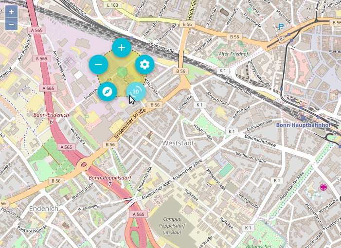
Circle Menu
Basically, we as terrestris and mundialis always want to take a pioneering role in our offer. This always includes breaking new ground and reinventing seemingly familiar things. The picture shows an illustration of the so-called circle menu, which should be more familiar from the world of online games, but also offers a good way to offer modern usability in a small space for WebGIS applications. The menu appears on a right-click in the map, and a wide variety of functions can be linked to it. As part of the game day, a prototype of the circle menu was integrated into our new client library, which is based on OpenLayers 3 and react.js.
This new library provides a fully responsive client and bears the working title “react_Geo”. The code will soon be available on Github.
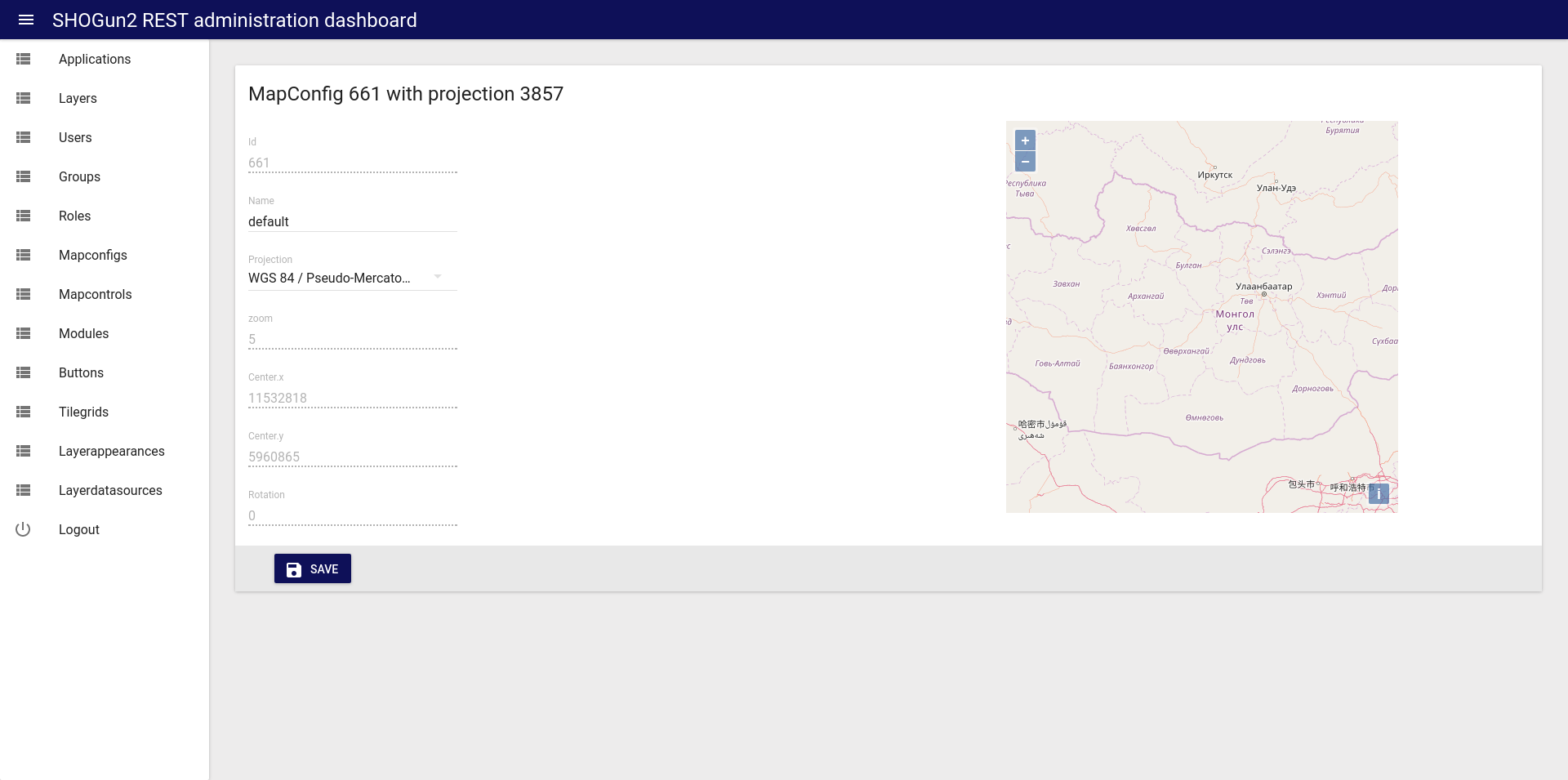
SHOGun2
As part of the game day, an evaluation was carried out to what extent the project “admin-on-rest (https://github.com/marmelab/admin-on-rest) can be used as a basis for the administration interfaces of SHOGun2. Admin-on-Rest is a framework that was specially created for the creation of administration interfaces based on Rest services. ReactJS, a JavaScvript library with
which we also create a new mapping framework for OpenLayers, and MaterialUI are used. Although the first attempts only took place within one day, they look very promising.
Likewise, code from SHOgun2 was cleaned up and supplementary tests were developed as part of the game day. The update, which is also already available on Github,
also establishes compatibility with the latest Spring version 4.3.5.
Sentinel2 Data
We also worked on our Sentinel2 data hub “maps.mundialis.de”. Here, in particular, on accommodating all color channels of atmospherically corrected Sentinel2 scenes in a GeoTiff and displaying them in various styles (GeoServer-SLD’s). The satellite image of the month and new postcards were also created on the game day.